|

Home
Roadklahoma Links:
Home
Terminus Page
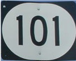
OK 101 Page
Intersecting Highways:
U.S. 59
OK 64B
Latest Updates
Interstate
Highways
U.S. Highways
State Highway
Terminus Gallery
E-mail OKHighways.com
(Spam filter in effect: Use @ in place of #) |
|
OKHighways.com
Terminus Gallery |
| |
|
 |
Highway Review:
OK 101 is the road to Sequoyah's home. Besides that, the highway
doesn't have too much purpose. The highway is straight for most of its run
between U.S. 59 and OK 64B, but after that, the highway is very curvy to the
Arkansas state line.
Highway Information:
Distance: 23.4 miles
Counties traveled through: Sequoyah
Highway intersections: U.S. 59 (Mile 0.0), OK 64B (Mile 13.0)
Highway duplexes: None
WESTERN
TERMINUS
U.S. 59, north of Sallisaw
 |
OK
101 West at U.S. 59. There is no "END"
sign at this terminus. (Photo taken 9/26/03) |
 |
OK
101 East assurance shield just east
of U.S. 59. OK 64B is 13 miles ahead.
(Photo taken 9/26/03) |
 |
U.S.
59 North at OK 101 East. (Photo
taken 9/26/03) |
OTHER
HIGHWAY PICTURES
 |
OK 101
West at OK 64B South. OK 64B
connects to Muldrow and Interstate 40.
(Photo taken 9/26/03) |
 |
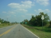
OK 101
West as it prepares to cross
Big Lee Creek. (Photo taken 9/26/03) |
EASTERN TERMINUS
Arkansas State Line, continues as AR
220
 |
"Welcome to Arkansas" sign as
OK 101
East comes to an end and AR 220
begins. (Photo taken 9/26/03) |
 |
"Welcome to Oklahoma" sign as
AR
220 West ends and OK 101 West
begins. (Photo taken 9/26/03) |
 |
OK 101
West assurance shield just
past the state line. It is only ten miles
to OK 64B, but it takes a while, due
to the ever-present curves along the
highway. (Photo taken 9/26/03) |
|


