|

Home
Roadklahoma Links:
Home
Terminus Page
OK 51A Page
Intersecting Highways:
OK 8
OK 8A
OK 51
OK 58 (N)
Latest Updates
Interstate
Highways
U.S. Highways
State Highway
Terminus Gallery
E-mail OKHighways.com
(Spam filter in effect: Use @ in place of #) |
|
OKHighways.com
Terminus Gallery |
| |
|
 |
Highway History:
1953: OK 51A was less than a mile long and connected OK 51 to Southard.
1959: OK 51A had been extended south to OK 8, but still had its other end at OK
51 west of Southard.
Highway Review:
OK 51A is the longest suffixed route in Oklahoma. It is 23 miles long and
connects OK 8 north of Watonga to OK 51 and OK 58. OK 51A has been resurfaced
and straightened out in recent years. During this process, its southern terminus
moved about two miles to the north.
Highway Information:
Distance: 23.0 miles
Counties traveled through: Blaine, Major
Highway intersections: OK 8 (Mile 0.0), OK 8A (Mile 4.4), OK 51 (Mile 14.9), OK
58 (Mile 23.0)
Highway duplexes: None
SOUTHERN TERMINUS
OK 8, north of Watonga
 |
"END OK 51A" signage at OK 8
as OK 51A South comes to an end.
(Photo taken 4/9/04) |
 |
First
OK 51A North assurance
shield just west of OK 8. The first
highway intersection OK 51A
sees is OK 8A in about 4 1/2
miles. (Photo taken 4/9/04) |
 |
OK 8
North at TO OK 51A North
near the Watonga Airport. For over
40 years, OK 51A began with a left
turn here. (Photo taken 4/9/04) |
 |
OK 8
North at OK 51A North. OK
51A now begins 1/2 mile to the
west of the southern terminus of
OK 8A. (Photo taken 4/9/04) |
OTHER
HIGHWAY PICTURES
 |
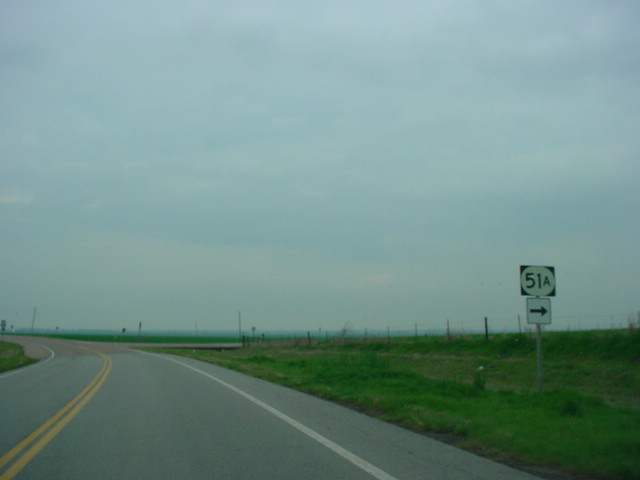
OK 51A
North at OK 8A South. OK
8A connects OK 8 and OK 51A to
the Roman Nose State Park.
(Photo taken 4/9/04) |
 |
OK 51A
North at TO OK 51 West
near Southard. The cross street
here is the original OK 51A that
connected OK 51 to Southard.
(Photo taken 4/9/04) |
 |
Looking westbound on the
original
OK 51A at OK 51. This marked
OK 51A's western terminus for
a few years, then it was the
northern terminus before the
highway was extended to OK 58.
(Photo taken 4/9/04) |
NORTHERN TERMINUS
OK 58, south of Fairview
 |
OK
51A North approaching OK
58. The highway makes a
sharp turn to the northwest
before ending. (Photo taken
4/9/04) |
 |
OK
51A North at OK 58. There
is no "END" sign at this terminus.
(Photo taken 4/9/04) |
 |
OK
51A South assurance
shield just south of OK 58.
The town of Southard is about
eight miles ahead. (Photo
taken 4/9/04) |
 |
OK 58
North at OK 51A
South. (Photo taken 4/9/04) |
|