|

Home
Intersecting Highways:
Interstate 35
Interstate 44
Indian Nation Turnpike
U.S. 69
U.S. 75
U.S. 77
U.S. 81
U.S. 177
U.S. 183
U.S. 259
U.S. 271
U.S. 277
U.S. 281
U.S. 377
OK 3
OK 5 (E)
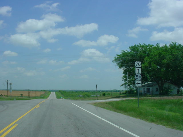
OK 5B
OK 22
OK 32
OK 36
OK 37 (S)
OK 54 (S)
OK 65
OK 70A (E)
OK 70A (W)
OK 70B
OK 70E
OK 70F
OK 76
OK 77S
OK 78
OK 79
OK 89
OK 93
OK 98
OK 99
OK 109
OK 147
OK 199
OK 209
Latest Updates
Interstate Highways
U.S. Highways
State Highway
Terminus Gallery
E-mail
OKHighways.com
(Spam filter in effect: Use @ in place of #) |
|
Highway
Review:
U.S. 70 begins its
almost cross-country trek in Globe, Arizona at the U.S. 60 and AZ
77 junction. It spans seven states on its journey (Arizona, New
Mexico, Texas, Oklahoma, Arkansas, Tennessee, and North Carolina)
and ends in the town of Atlantic close to, appropriately enough,
the Atlantic Ocean.
Its run in Oklahoma
begins with U.S. 183 south of Davidson. The highways are joined
for three miles in Oklahoma before U.S. 70 heads its separate way.
Thirty-four miles later, the highway intersects Interstate 44 (Exit 5). U.S. 70 continues heading due
east just a few miles north of the Red River and Texas for
several miles, and travels through Waurika, Ringling, and Lone
Grove. Just east of Ringling, the highway expands from 2 lanes to
a 4-lane divided highway. The highway maintains a 65 mph speed
limit for its distance with the exception of slowdowns for towns
and major intersections at OK 79 and U.S. 81.
Just west of Ardmore
U.S. 70 joins Interstate 35 and heads south for two miles. (FYI-The
interchange is also the western terminus of OK 199) U.S. 70 exits
off and heads east once again at Exit 29 as it heads towards the
Lake Texoma area. Major highway intersections in the area are at
U.S. 77 (just east of I-35), U.S. 177 in Madill (U.S. 177's
southern terminus) and U.S. 377/OK 99 in Madill. Near the town of
Kingston U.S. 70 crosses Lake Texoma. This section of U.S. 70 is
one of its most scenic in Oklahoma. About 20 miles east of
Kingston U.S. 70 enters the town of Durant and intersects the U.S.
69/75 freeway on the western side of town. Be sure to pay
attention to the signs if traveling along U.S. 70 in downtown
Durant; it does make a left turn in downtown and if unfamiliar
with the area, it can make you have to turn around and go back.
Heading east on U.S.
70 motorists encounter four towns in a row that begin with "B":
Blue, Bokchito, Bennington (actually is a mile south of U.S. 70
on OK 70E), and Boswell. West of Hugo U.S. 271 South joins U.S.
70 East until the Indian Nation Turnpike, when U.S. 70 East and U.S.
271 South traffic heads south on the freeway bypass around the
southwest side of Hugo. U.S. 70 then winds its way to Idabel,
where there is a bypass of the highway. Northeast of town U.S. 70
joins U.S. 259 North for eight miles before breaking apart in
Broken Bow. Sixteen miles later, U.S. 70 enters Arkansas and
continues making its way towards the Atlantic Ocean.
Highway
Information:
Distance: 294.6 miles
Counties traveled through: Tillman, Cotton, Jefferson, Carter, Marshall, Bryan,
Choctaw, McCurtain
Highway intersections: U.S. 183 (Mile 2.6), OK 54 (Mile 14.2), OK 36 (Mile
25.6), OK 36 (Mile 35.9), Interstate 44/U.S. 277/U.S. 281 (Mile 37.1), U.S.
277/U.S. 281 (Mile 39.9), OK 5B (Mile 46.9), OK 65 (Mile 52.0), OK 79 (Mile
63.8), OK 5 (Mile 66.0), U.S. 81 (Mile 67.1), OK 89 (Mile 89.6), OK 76 (Mile
96.4), OK 76 (Mile 99.0), OK 70A (Mile 99.8), Interstate 35/OK 199 (Mile
113.8), Interstate 35 (Mile 116.2), U.S. 77 (Mile 117.2), OK 77S (Mile 119.2),
OK 77S (Mile 123.9), U.S. 177/OK 199 (Mile 138.7), U.S. 377/OK 99/OK 199 (Mile
139.4), U.S. 377/OK 99 (Mile 139.8), OK 70F (Mile 141.4), OK 32 (Mile 146.8), OK
70B (Mile 146.9), OK 70A (Mile 147.3), U.S. 69/U.S. 75 (Mile 165.1), Business
U.S. 69 (Mile 166.2), OK 78 (Mile 166.8), OK 78 (Mile 167.3), OK 22 (Mile
180.7), OK 70E (Mile 187.3), OK 109 (Mile 197.4), U.S. 271 (Mile 211.9), Indian
Nation Turnpike/Business U.S. 70/Business U.S. 271 (Mile 216.5), U.S.
271/Business U.S. 271 (Mile 219.9), Business U.S. 70 (Mile 222.9), OK 93 (Mile
223.2), OK 147 (Mile 229.6), OK 109 (Mile 234.9), OK 209 (Mile 236.2), OK 98
(Mile 249.2), Business U.S. 70 (Mile 261.8), OK 37 (Mile 263.8), U.S. 259 (Mile
266.2), Business U.S. 70/OK 3 (Mile 269.1), U.S. 259/OK 3 (Mile 278.9)
Highway duplexes: U.S. 183 (Miles 0.0-2.6, 2.6 miles), OK 36 (Miles 25.6-35.9,
10.3 miles), U.S. 277/U.S. 281 (Miles 37.1-39.9, 2.8 miles), OK 76 (Miles
96.4-99.0, 2.6 miles), Interstate 35 (Miles 113.8-116.2, 2.4 miles), OK 199
(Miles 138.7-139.4, 0.7 mile), U.S. 377/OK 99 (Miles 139.4-139.8, 0.4 mile), OK
78 (Miles 166.8-167.3, 0.5 mile), U.S. 271 (Miles 211.9-219.9, 8.0 miles), U.S.
259 (Miles 266.2-278.9, 12.7 miles), OK 3 (Miles 269.1-278.9, 9.8 miles)
PICTURES
|