OKHighways.com

Home


Intersecting Highways:

Interstate 40

Interstate 44

Indian Nation Turnpike

Muskogee Turnpike

U.S. 59

U.S. 60

U.S. 62

U.S. 64

U.S. 70

U.S. 75

U.S. 266

U.S. 270

U.S. 412

OK 1

OK 2 (N)

OK 3

OK 7

OK 9

OK 9A (C)

OK 10

OK 16

OK 20

OK 22

OK 28

OK 31

OK 43

OK 51

OK 51B

OK 63

OK 69A (N)

OK 69A (S)

OK 78

OK 82 (N)

OK 85

OK 91

OK 113

OK 125

OK 131

OK 150


Latest Updates

Interstate Highways

U.S. Highways

State Highway
Terminus Gallery

E-mail OKHighways.com
(Spam filter in effect: Use @ in place of #)


U.S. Highways @ OKHighways.com
 

U.S. 69

Highway Review:
U.S. 69 runs from Port Arthur, Texas, to Albert Lea, Minnesota, near the northern terminus of U.S. 65. It runs through Texas, Oklahoma, Kansas, Missouri, Iowa, and Minnesota. From Port Arthur, U.S. 69 is duplexed with U.S. 96 and U.S. 287 until they split in Beaumont.

In Oklahoma, U.S. 69 is 4-lane divided expressway for almost its entire length. It starts out duplexed with U.S. 75 just north of the Sherman and Denison, Texas area. U.S. 75 departs in Atoka, and U.S. 69 continues straight ahead towards McAlester. From McAlester to Muskogee, U.S. 69 is a freeway. The freeway crosses over Lake Eufaula a few miles south of the cloverleaf interchange at Interstate 40. After entering Muskogee from the southwest, U.S. 64 joins U.S. 69, and the freeway ends. U.S. 69 skirts the western side of Muskogee, and U.S. 62, U.S. 64, and OK 16 each share roadway with U.S. 69. After leaving U.S. 62 and OK 16 behind, U.S. 69 continues as a 4-lane divided highway. Access to the Muskogee Turnpike is available five miles north of Muskogee. After heading through Wagoner, U.S. 69 intersects U.S. 412 at a cloverleaf interchange and enters the town of Chouteau. Just north of Chouteau is OK 69A and the Mid-America Industrial Park. The Mayes County seat of Pryor is next on the northward trek on U.S. 69, and 18 miles north of its intersection with OK 20 in Pryor, U.S. 69 intersects Interstate 44 and the 4-lane section ends. The highway then heads to the east duplexed with U.S. 60 through the town of Vinita and another two intersections with Interstate 44. After finally leaving Interstate 44 behind for good, U.S. 69 heads through Miami, Commerce, and Picher, and the highway enters the state of Kansas just north of Picher.

Highway Information:
Distance: 263.4 miles
Counties traveled through: Bryan, Atoka, Pittsburg, McIntosh, Muskogee, Wagoner, Mayes, Craig, Delaware, Ottawa
Highway intersections: OK 91 (Mile 2.2), Bus. U.S. 69/75 (Mile 10.9), U.S. 70 (Mile 15.1), OK 78 (Mile 18.0), Bus. U.S. 69/75 (Mile 19.6), OK 22 (Mile 27.2), OK 7 (Mile 46.3), OK 3 (Mile 47.2), U.S. 75 (Mile 47.7), OK 43 (Mile 54.5), OK 43 (Mile 59.6), OK 131 (Mile 70.0), OK 63 (Mile 74.5), Indian Nation Turnpike (Mile 85.7), Bus. U.S. 69 (Mile 87.8), U.S. 270/OK 1/31 (Mile 92.3), Bus. U.S. 69 (Mile 97.3), OK 113 (Mile 110.7), OK 9A (Mile 114.7), Bus. U.S. 69 (Mile 118.2), OK 9 (Mile 120.9), OK 150 (Mile 125.8), Interstate 40 (Mile 132.6), U.S. 266 (Mile 133.9), Bus. U.S. 69 (Mile 135.8), U.S. 64 (Mile 152.9), U.S. 62/U.S. 64//OK 16 (Mile 155.9), U.S. 62/OK 16 (Mile 156.9), OK 51B (Mile 161.7), Muskogee Turnpike (Mile 161.9), OK 51 (Mile 170.3), U.S. 
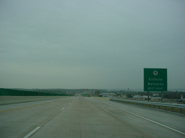
412 (Mile 185.0), OK 69A (Mile 190.9), OK 20 (Mile 195.2), OK 28 (Mile 204.7), Interstate 44 (Mile 214.4), U.S. 60 (Mile 218.7), OK 2 (Mile 222.5), Interstate 44 (Mile 223.5), OK 82 (Mile 227.9), OK 85 (Mile 232.4), U.S. 59 (Mile 239.7), Interstate 44/U.S. 60 (Mile 240.5), U.S. 59/OK 10 (Mile 250.6), OK 10/125 (Mile 252.4), OK 69A (Mile 259.0), OK 69A (Mile 259.6)
Highway duplexes: U.S. 75 (Miles 0.0-47.7, 47.7 miles), OK 43 (Miles 54.5-59.6, 5.1 miles), U.S. 64 (Miles 152.9-155.9, 3.0 miles), U.S. 62/OK 15 (Miles 155.9-156.9, 1.0 mile), U.S. 60 (Miles 218.7-240.5, 21.8 miles), U.S. 59 (Miles 239.7-250.6, 10.9 miles), OK 10 (Miles 250.6-252.4, 1.8 miles)

PICTURES

U.S. 69/U.S. 75 North as the highways enter
Oklahoma. (Photo taken 5/31/04)
U.S. 69/U.S. 75 North at River Rd. (Photo taken
5/31/04)
U.S. 69/U.S. 75 North at OK 91 - Colbert/
Denison Dam. (Photo taken 5/31/04)
U.S. 69/U.S. 75 South at OK 91 - Colbert/
Denison Dam. (Photo taken 5/31/04)
U.S. 69/U.S. 75 South at Colbert/Platter. (Photo
taken 5/31/04)
U.S. 69/U.S. 75 South at Business U.S. 69 near
Calera. (Photo taken 5/31/04)
U.S. 69/U.S. 75 South at U.S. 70 - Durant/
Lake Texoma. (Photo taken 5/31/04)
U.S. 69/U.S. 75 South at Washington Ave. in
Durant. (Photo taken 5/31/04)
U.S. 69/U.S. 75 South at OK 48 North via OK
78 - Durant. (Photo taken 5/31/04)
U.S. 69/U.S. 75 South at Armstrong/Durant
State Fish Hatchery. (Photo taken 5/31/04)
U.S. 69/U.S. 75 South at the Stockyard exit.
(Photo taken 5/31/04)
U.S. 69/U.S. 75 South at OK 22 - Caddo/
Kenefic. (Photo taken 5/31/04)
U.S. 69/U.S. 75 South/OK 3 East at OK 3
East/OK 7 West/Bypass OK 3 in Atoka. This is
the eastern terminus of OK 7, which goes to
Lawton at its other end. (Photo taken 5/31/04)
U.S. 69/U.S. 75 South/OK 3 East at Business
OK 3 in Atoka. (Photo taken 5/31/04)
U.S. 69 South at U.S. 75 North/OK 3 West -
Coalgate/Ada. (Photo taken 5/31/04)
U.S. 69 South/OK 43 East at OK 43 East -
Daisy. (Photo taken 5/31/04)
U.S. 69 South at OK 43 West - Coalgate.
(Photo taken 5/31/04)
U.S. 69 South at OK 131 West - Wardville.
(Photo taken 5/31/04)
U.S. 69 North at OK 63 East in Kiowa. (Photo
taken 5/31/04)
U.S. 69 South at OK 63 East. (Photo taken
5/31/04)
U.S. 69 North at Business U.S. 69 - McAlester.
(Photo taken 5/31/04)
U.S. 69 North at U.S. 270/OK 1/OK 31 East -
Krebs/Wilburton. (Photo taken 5/31/04)
U.S. 69 North at U.S. 270/OK 1/OK 31 West -
McAlester. (Photo taken 5/31/04)
U.S. 69 North at Gene Stipe Blvd. in McAlester.
Mr. Stipe was a longtime state senator who got
into a bit of legal trouble, which forced him to
resign in 2003 after serving on the senate for
almost 50 years. (Photo taken 5/31/04)
U.S. 69 North at OK 113 North - Indianola.
(Photo taken 5/31/04)
U.S. 69 South at OK 113 - Canadian/Indianola/
Arrowhead State Park. (Photo taken 10/31/03)
View at the end of the off-ramp from U.S. 69
South to OK 113.
(Photo taken 10/31/03)
U.S. 69 North at OK 9A East/TO OK 9 - Stigler.
(Photo taken 10/31/03)
U.S. 69 North approaching Business U.S. 69 -
Eufaula -1 mile. The highway is crossing Lake
Eufaula at this point.
(Photo taken 10/31/03)
U.S. 69 North at Business U.S. 69 - Eufaula.
(Photo taken 10/31/03)
U.S. 69 North at OK 9 - Eufaula/Wetumka.
(Photo taken 10/31/03)
U.S. 69 South at OK 9 - Eufaula/Wetumka.
(Photo taken 10/31/03)
View from the end of the off-ramp from U.S. 69
South to OK 9. (Photo taken 10/31/03)
U.S. 69 South at Business U.S. 69 - Eufaula.
(Photo taken 10/31/03)
U.S. 69 North at OK 150 - Texanna Road/Lake
Eufaula State Park.
(Photo taken 10/31/03)
BGS at the off-ramp from U.S. 69 North to OK
150.
(Photo taken 10/31/03)
U.S. 69 North at OK 51B West. (Photo taken
10/31/03)
U.S. 69 North at Muskogee Turnpike East - Ft.
Smith.
(Photo taken 10/31/03)
U.S. 69 North at Muskogee Turnpike West -
Tulsa.
(Photo taken 10/31/03)
U.S. 69 North approaching OK 51 in Wagoner.
These large shields are in place along U.S.
69 in Wagoner County.
(Photo taken 10/31/03)
U.S. 69 North at OK 51 in Wagoner. (Photo
taken 10/31/03)
U.S. 69 South at OK 69A north of Chouteau. OK
69A leads to the Mid-America Industrial Park and
Sportsman Acres. (Photo taken 2/14/03)
U.S. 69 South at OK 20 in Pryor. OK 20 spans
144 miles from OK 18 near Ralston to the
Missouri State Line. (Photo taken 2/14/03)
U.S. 69 North at OK 28 in Adair. (Photo taken
11/26/04)
U.S. 60 East/U.S. 69 North at OK 2 in Vinita. OK
2 spans 17 miles and connects to U.S. 59 and OK
10 on its northern end. (Photo taken 4/25/03)
U.S. 60 West/U.S. 69 South at Interstate 44 in
Vinita. (Photo taken 4/25/03)
U.S. 59/U.S. 69 North at U.S. 59 North/OK 10
West near Miami. U.S. 59 ends its duplex and OK
10 begins its duplex here. (Photo taken 4/25/03)
U.S. 69 North/OK 10 East assurance shields just
north of the intersection pictured above. The two
highways will split in two miles in Miami. (Photo
taken 4/25/03)
U.S. 69 North/OK 10 East at OK 125 South in
Miami. (Photo taken 4/25/03)
U.S. 69 North/OK 10 East at U.S. 69 North in
Miami. OK 10 will intersect OK 69A and Interstate
44 in a mile. (Photo taken 4/25/03)

U.S. 69/OK 69A North assurance shields. The
two same-numbered highways shared a 1/2 mile
duplex before OK 69A was truncated to end just
behind this photo. (Top photo taken 4/25/03,
bottom photo taken 5/20/05)
U.S. 69 North approaching Alternate U.S. 69.
The main U.S. 69 highway turns off this road.
Kansas is three miles to the north. The two
U.S. 69's reunite near Crestline, KS.
(Photo
taken 5/20/05)

U.S. 69 North at Alternate U.S. 69 North. U.S. 69
turns left and heads towards Picher. Alternate
U.S. 69 continues straight ahead and enters the
town of Quapaw in three miles. (Top photo taken
4/25/03, bottom photo taken 5/20/05)
U.S. 69 North as it leaves Oklahoma and enters
the state of Kansas and Cherokee County. To
see pictures of U.S. 69 in Kansas, visit the
U.S. 69 Kansas guide at OKRoads.
(Photo
taken 5/20/05)