|

Home
Intersecting Highways:
Interstate 35
Interstate 40
Interstate 44
Interstate 244
Creek Turnpike
Muskogee Turnpike
U.S. 54
U.S. 56
U.S. 59
U.S. 60
U.S. 62
U.S. 69
U.S. 75
U.S. 77
U.S. 81
U.S. 83
U.S. 169
U.S. 177
U.S. 183
U.S. 266
U.S. 270
U.S. 281
U.S. 283
U.S. 287
U.S. 385
U.S. 412
OK 2 (S)
OK 3
OK 8
OK 10
OK 11
OK 14
OK 15 (E)
OK 16
OK 18
OK 23
OK 34
OK 38
OK 46
OK 48
OK 50
OK 51
OK 58 (N)
OK 64B
OK 64D
OK 67
OK 72
OK 74 (N)
OK 82 (N)
OK 94
OK 95
OK 97
OK 97T
OK 99
OK 100
OK 104
OK 108
OK 132
OK 136
OK 141
OK 151
OK 162
OK 165
OK 171
OK 325
Latest Updates
Interstate Highways
U.S. Highways
State Highway
Terminus Gallery
E-mail
OKHighways.com
(Spam filter in effect: Use @ in place of #) |
|
Highway
Review:
U.S. 64 is the longest U.S. highway in the state of
Oklahoma. At just less than 600 miles, it is the second longest
highway in Oklahoma, behind only OK 3. From a nationwide
perspective, U.S. 64 runs from the town of Teec Nos Pos, Arizona
(in the far NE corner of the state) to the Atlantic Ocean near
Nags Head, North Carolina.
In Oklahoma, U.S. 64
enters the state in the panhandle from New Mexico duplexed with
U.S. 56 and U.S. 412. U.S. 64's first 40 miles in Oklahoma are
duplexed with U.S. 56, while U.S. 412 doesn't leave U.S. 64
behind until 94 miles into the state. U.S. 64 and U.S. 412 share
two other duplexes in the Sooner State; one between Enid and
Interstate 35, and the other between the eastern terminus of the
Cimarron Turnpike and Interstate 244 in Tulsa.
U.S. 64's first 185
miles are in the panhandle. Its first intersection out of the
panhandle is at U.S. 283. U.S. 64 shares four miles with U.S.
283. The highway then continues on to Buffalo, where U.S. 183
joins U.S. 64. The next major town for U.S. 64 is Alva, where
U.S. 281 has a mile-long duplex with U.S. 64. U.S. 64 enters the
Enid area about 70 miles later duplexed with U.S. 60 West and
U.S. 81 South. U.S. 64 heads off on its own, however, in north
Enid. In the far eastern part of Enid, U.S. 64 makes a left turn
to join U.S. 412 for 28 miles until they split at Interstate 35.
The stretch between Enid and the interstate is 4-lane divided
expressway with one interchange present at OK 15 East/OK 74. U.S.
64 heads south on the interstate as U.S. 412 continues straight
ahead as the Cimarron Turnpike. They will rejoin at the eastern
terminus of the turnpike west of Tulsa.
U.S. 64's run with
Interstate 35 ends eight miles after it began, when U.S. 64 exits
off at Exit 186. U.S. 64 enters the town of Perry two miles later
and has a short duplex with U.S. 77. East of the town of
Morrison, U.S. 64 intersects U.S. 412/Cimarron Turnpike. U.S. 64
then heads through Pawnee County, serving the towns of Pawnee and
Cleveland. At Cleveland, U.S. 64 makes a turn to the right and
heads to the south and east for a few miles to rejoin U.S. 412.
Just before merging with U.S. 412, U.S. 64 has an intersection
with OK 48, whose northern terminus is at this location.
U.S. 64 and U.S. 412
have rejoined and continue heading towards Tulsa as the Keystone
Expressway, named after the lake that the highways cross during
its route. There is one at-grade intersection, but otherwise
there are overpasses and interchanges at other major highways and
streets. Some of the oldest signs in Oklahoma are located along
the Keystone Expressway. Just northwest of downtown Tulsa, U.S.
64 exits off to the south to join Interstate 244 for about a mile
before heading east with OK 51 and U.S. 75 along the hidden
Interstate 444. After leaving U.S. 75 behind, U.S. 64 and OK 51
become the Broken Arrow Expressway. After a cloverleaf
interchange with Interstate 44, U.S. 64 heads towards U.S. 169,
where it exits and heads south for several miles. The Creek
Turnpike joins U.S. 64/169 (known as the Mingo Valley Expressway)
for about a mile. U.S. 64 exits off before the Creek Turnpike's
west section begins, and U.S. 169 South comes to an end at that
interchange as well.
U.S. 64 now heads due
south along Memorial Drive to serve south Tulsa and the
rapidly-growing suburb of Bixby. Beware of traffic backups,
especially for U.S. 64 West travelers at the OK 67 stoplight. The
highway is two lanes at that point and needs to be at least four
because of the rapid growth. Just south of OK 67 and Bixby, U.S.
64 curves to the east, but continues heading mostly to the south
all the way to the U.S. 62/OK 16 intersection several miles west
of Muskogee. Before the three highways enter Muskogee's downtown,
they split, and U.S. 64 heads to the south with U.S. 69 for three
miles. Then U.S. 64 heads due east for a mile before heading
south again at OK 165.
The highway continues
heading basically due south for 16 miles before entering the town
of Warner, where it turns to the east at the U.S. 266/OK 2
intersection west of town. For the rest of its time in Oklahoma,
U.S. 64 closely parallels Interstate 40. After an intersection
with the Muskogee Turnpike (by the way, there is an off-ramp from
the Muskogee Turnpike East and an on-ramp to the Muskogee
Turnpike West only) U.S. 64 joins OK 100, where the two highways
head through the Arkansas River towns of Webbers Falls and Gore.
The bridge across the river became crowded with interstate
travelers after the bridge collapse of May 26, 2002, because U.S.
64 was the nearest river bridge to the collapsed bridge on the
interstate, and westbound traffic was rerouted across the U.S. 64
bridge. After crossing the bridge, motorists enter the town of
Gore, where OK 100 leaves U.S. 64 behind and OK 10 joins U.S. 64
for about three miles. The final major stop along U.S. 64 is
Sallisaw, the county seat of Sequoyah County, where U.S. 59 joins
U.S. 64 for a mile. After leaving Sallisaw, there are just 22
miles remaining before entering Arkansas. Two intersections with
Interstate 40 (one just east of Sallisaw, another one near
Roland) and three state highways (including two spur routes, OK
64B and OK 64D) later, U.S. 64 finally leaves the Sooner State
behind, 588.7 miles after entering the state! U.S. 64 immediately
enters Fort Smith, Arkansas upon leaving Oklahoma.
Highway
Information:
Distance: 588.7 miles
Counties traveled through: Cimarron, Texas, Beaver, Harper,
Woods, Alfalfa, Grant, Garfield, Noble, Pawnee, Osage, Tulsa,
Wagoner, Muskogee, Sequoyah
Highway intersections: U.S. 385 (Mile 28.4), U.S. 287/OK 3/325
(Mile 31.7), U.S. 287 (Mile 33.5), U.S. 56 (Mile 39.5), OK 171
(Mile 47.2), OK 95 (Mile 66.0), OK 95 (Mile 71.0), OK 136 (Mile
89.4), U.S. 412/OK 3/136 (Mile 93.5), U.S. 54 (Mile 94.3), OK 94
(Mile 112.7), U.S. 54 (Mile 113.2), U.S. 83 (Mile 131.3), U.S.
83/270 (Mile 134.4), U.S. 270/OK 23 (Mile 154.4), OK 23 (Mile
155.3), U.S. 283 (Mile 186.6), U.S. 283 (Mile 190.7), OK 46 (Mile
199.0), U.S. 183 (Mile 205.9), U.S. 183 (Mile 207.4), OK 34 (Mile
221.6), OK 34 (Mile 225.0), OK 50 (Mile 236.8), OK 14 (Mile
250.1), U.S. 281 (Mile 262.1), U.S. 281 (Mile 263.1), OK 8/11/58
(Mile 279.0), OK 8 (Mile 288.1), OK 58 (Mile 294.0), OK 38 (Mile
298.0), OK 132 (Mile 305.0), OK 132 (Mile 307.0), U.S. 60/81
(Mile 315.0), OK 45 (Mile 329.0), U.S. 60/81 (Mile 330.0),
Business U.S. 64 (Mile 331.7), U.S. 412 (Mile 335.9), OK 15/74
(Mile 349.9), Interstate 35/U.S. 412 (Mile 364.2), Interstate 35
(Mile 371.8), U.S. 77 (Mile 374.2), U.S. 77 (Mile 374.3), U.S.
177 (Mile 386.4), U.S. 412/Cimarron Turnpike (Mile 390.9), OK 108
(Mile 394.9), OK 18 (Mile 402.3), OK 18 (Mile 404.4), OK 99 (Mile
417.0), OK 99 (Mile 423.2), OK 48 (Mile 430.8), U.S. 412/Cimarron
Turnpike (Mile 431.4), OK 151 (Mile 440.5), OK 97T (Mile 447.3),
OK 51/97 (Mile 448.5), Interstate 244/U.S. 412 (Mile 455.2),
Interstate 244/U.S. 75 (Mile 456.0), U.S. 75 (Mile 457.4),
Interstate 44 (Mile 462.7), U.S. 169/OK 51 (Mile 465.1), Creek
Turnpike (Mile 470.3), U.S. 169/Creek Turnpike (Mile 471.3), OK
67 (Mile 477.1), OK 72 (Mile 494.1), OK 104 (Mile 494.4), U.S.
62/OK 16/OK 72 (Mile 500.3), OK 162 (Mile 505.3), U.S. 62/69/Business
U.S. 62/OK 16 (Mile 514.1), U.S. 69 (Mile 517.1), Business U.S.
64/OK 165 (Mile 518.1), U.S. 266/OK 2 (Mile 534.3), Muskogee
Turnpike (Mile 542.3), OK 100 (Mile 544.0), OK 10/100 (Mile
546.3), OK 10 (Mile 549.0), OK 82 (Mile 555.3), U.S. 59 (Mile
565.6), U.S. 59 (Mile 566.8), Interstate 40 (Mile 568.6), OK 141
(Mile 574.8), OK 64B (Mile 579.0), Interstate 40 (Mile 583.0), OK
64D (Mile 587.5)
Highway duplexes: U.S. 56 (Miles 0.0-39.5, 39.5 miles), U.S. 412
(Miles 0.0-93.5, 93.5 miles), U.S. 287 (Miles 31.7-33.5, 1.8
miles), OK 3 (Miles 31.7-93.5, 61.8 miles), OK 95 (Miles
66.0-71.0, 5.0 miles), OK 136 (Miles 89.4-93.5, 4.1 miles), U.S.
54 (Miles 94.3-113.2, 18.9 miles), U.S. 270 (Miles 134.4-154.4,
20.0 miles), OK 23 (Miles 154.4-155.3, 0.9 miles), U.S. 283
(Miles 186.6-190.7, 4.1 miles), U.S. 183 (Miles 205.9-207.4, 1.5
miles), OK 34 (Miles 221.6-225.0, 3.4 miles), U.S. 281 (Miles
262.1-263.1, 1.0 mile), OK 8 (Miles 279.0-288.1, 9.1 miles), OK
58 (Miles 279.0-294.0, 15.0 miles), OK 132 (Miles 305.0-307.0,
2.0 miles), U.S. 60/81 (Miles 315.0-330.0, 15.0 miles), U.S. 412
(Mile 335.9-364.2, 28.3 miles), Interstate 35 (Miles 364.2-371.8,
7.6 miles), U.S. 77 (Miles 374.2-374.3, 0.1 mile), OK 18 (Miles
402.3-404.4, 2.1 miles), OK 99 (Miles 417.0-423.2, 6.2 miles),
U.S. 412 (Miles 431.4-455.2, 23.8 miles), Interstate 244 (Miles
455.2-456.0, 0.8 miles), OK 51 (Miles 448.5-465.1, 16.6 miles),
U.S. 75 (Miles 456.0-457.4, 1.4 miles), U.S. 169 (Miles
465.1-471.3, 6.2 miles), Creek Turnpike (Miles 470.3-471.3, 1.0
mile), OK 72 (Miles 494.1-500.3, 6.2 miles), U.S. 62/OK 16 (Miles
500.3-514.1, 13.8 miles), U.S. 69 (Miles 514.1-517.1, 3.0 miles),
OK 100 (Miles 544.0-546.3, 2.3 miles), OK 10 (Miles 546.3-549.0,
2.7 miles), U.S. 59 (Miles 565.6-566.8, 1.2 miles)
PICTURES
 |
U.S. 56/U.S. 64/U.S. 412 East as the
highways enter the
Sooner State. U.S. 56 will leave the state in just 71 miles, but
U.S. 64 won't leave Oklahoma for 589 miles and U.S. 412
won't leave Oklahoma for 502 miles. (Photo taken 5/7/04) |
 |
U.S. 56/U.S. 64/U.S. 412 East at
U.S. 385 South west of
Boise City. (Photo taken 5/7/04) |
 |
U.S. 56/U.S. 64/U.S. 412 East/U.S.
385 North at the Boise
City traffic circle. Traffic wanting to continue on U.S. 56/U.S.
64/U.S. 412 East make 1/4 of a circle from this point. In
other words, they turn right at the first street in the circle.
(Photo
taken 5/7/04) |
 |
U.S. 56/U.S. 64/U.S. 412/OK 3 West/U.S.
287 North at the
Boise City traffic circle. The Cimarron County Courthouse is
in the middle of this traffic circle. U.S. 287, U.S. 385, and OK 3
go north, OK 325 goes due west, and U.S. 56, U.S. 64, U.S.
385, and U.S. 412 go south from this traffic circle. (Photo
taken 5/7/04) |
 |
Inside the traffic circle, this would be U.S. 56/U.S. 64/U.S. 412/
OK 3 East/U.S. 287 South/U.S. 385
North at U.S. 56/U.S. 64/
U.S. 412/OK 3 East/U.S. 287 South. U.S. 64 and OK 3 are not
signed here, but that is all right. There are too many highways
here to fit them all into one sign! (Photo taken 5/7/04) |
 |
Inside the traffic circle, this would be U.S. 56/U.S. 64/U.S. 412/
OK 3 West/U.S. 287/U.S. 385 North at
U.S. 287/U.S. 385 North/
OK 3 West. U.S. 287 does eventually connect to Denver, and a
sign just north of town gives the mileage to Colorado's capital
city. (Photo taken 5/7/04) |
 |
Inside the traffic circle, this would be U.S. 56/U.S. 64/U.S. 412
West/U.S. 287/U.S. 385 South/OK 3
East at OK 325 West -
Kenton. OK 325 is 38 miles long and these highways here are the
only ones it connects to. It is also the highway that one takes to
get to Black Mesa, Oklahoma's highest point. (Photo taken
5/7/04) |
 |
Inside the traffic circle, this would be U.S. 56/U.S. 64/U.S. 412
West/U.S. 287/U.S. 385 South/OK 3
East at U.S. 56/U.S. 64/
U.S. 412 West/U.S. 385 South. U.S. 385 is left off of this sign.
(Photo taken 5/7/04) |
 |
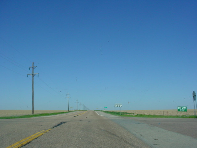
U.S. 56/U.S. 64/U.S. 412/OK 3 West/U.S.
287 North assurance
shields just east of Boise City. This area is known for its
highway multiplexes. (Photo taken 5/7/04) |
 |
U.S. 56/U.S. 64/U.S. 412/OK 3 East/U.S.
287 South at U.S.
287 South. (Photo taken 5/7/04) |
 |
U.S. 56/U.S. 64/U.S. 412/OK 3 East
at U.S. 56 East. (Photo
taken 5/7/04) |
 |
U.S. 64/U.S. 412/OK 3 West at OK 171. There are no
signs at the
actual
intersection for OK 171. I counted more deer on OK 171
than
other vehicles on this day! (Photo taken 5/7/04) |
 |
U.S. 64/U.S. 412/OK 3 West/OK 95
North at OK 95 North.
(Photo taken 5/7/04) |
 |
U.S. 64/U.S. 412/OK 3 West/OK 95
North assurance shields
in western Texas County. OK 95 runs along this road for five
miles. (Photo taken 5/7/04) |
 |
U.S. 64/U.S. 412/OK 3 East/OK 136
South assurance shields
just north of Guymon. (Photo taken 5/7/04) |
 |
U.S. 64/U.S. 412/OK 3 East/OK 136
South at U.S. 64 East in
Guymon. This is also the truck route for U.S. 64, U.S. 412, OK
3, and OK 136 traffic to bypass downtown Guymon, which is
less than a mile ahead. (Photo taken 5/7/04) |
 |
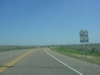
U.S. 54/U.S. 64 West at OK 94 South
in Hooker. OK 94
connects to U.S. 412/OK 3 near Hardesty. (Photo taken 5/7/04) |
 |
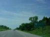
U.S. 64 East/U.S. 83 North at U.S.
64/U.S. 270 East north of
Turpin. (Photo taken 5/6/04) |
 |
U.S. 64 West/OK 23 South at U.S. 270
East/OK 23 South near
Forgan. (Photo taken 5/6/04) |
 |
U.S. 64 West at OK 23 North.
(Photo taken 5/6/04) |
 |
U.S. 64 West/U.S. 283 North at U.S.
283 North. (Photo taken
5/6/04) |
 |
U.S. 64 West at OK 46 South. OK 46
connects to U.S. 60/U.S.
283/OK 51 in Arnett at its other end. (Photo taken 5/6/04) |
 |
U.S. 64 West/U.S. 183 South at U.S.
64 West south of Buffalo.
The two highways duplex for about 1 1/2 miles. (Photo taken
5/6/04) |
 |
U.S. 64 West at U.S. 183 North near
Buffalo. (Photo taken
5/6/04) |
 |
U.S. 64 West/OK 34 South at OK 34
South. (Photo taken
5/6/04) |
 |
U.S. 64 West at OK 34 North.
(Photo taken 5/6/04) |
 |
U.S. 64 West at OK 50 South.
(Photo taken 5/6/04) |
 |
U.S. 64 East at U.S. 281 South in
Alva. (Photo taken 4/9/04) |
 |
U.S. 64 West/U.S. 281 South at U.S.
281 South. Northwest
Oklahoma State University is located on the southwest corner
of this intersection. (Photo taken 4/9/04) |
 |
U.S. 64 East/U.S. 281 North at U.S.
281 North. (Photo taken
4/9/04) |
 |
U.S. 64 West at U.S. 281 North.
(Sorry about the blurriness.)
(Photo taken 4/9/04) |
 |
U.S. 64 East at OK 38 North in Jet. OK 38 connects to the
Great Salt Plains State Park and OK 11. (Photo taken
7/18/03) |
 |
U.S. 64 East at OK 132 North. (Photo taken 7/18/03) |
 |
U.S. 64 East/OK 132
South at OK 132 South. (Photo taken
7/18/03) |
 |
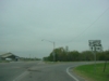
U.S. 60 West/U.S.
64 East/U.S. 81 South at OK 45 West. (Photo
taken 7/18/03) |
 |
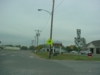
U.S. 60 West/U.S.
64 East/U.S. 81 South at U.S. 64 East in
North Enid. This ends the 15-mile triplex of the federal
highways.
(Photo taken 7/18/03) |
 |
U.S. 64/U.S. 412
West at OK
15 East/OK 74 - Garber/Covington
exit. The diamond interchange is located halfway between
Enid
and Interstate 35. (Photo taken 7/18/03) |
 |
U.S. 64/U.S. 412 East approaching
Interstate 35/Cimarron
Turnpike - 1 mile. (Photo taken 5/21/04) |
 |
U.S. 64/U.S. 412 East approaching
Interstate 35 - 3/4 mile.
(Photo taken 5/21/04) |
 |
U.S. 64/U.S. 412 East approaching
Interstate 35 South/U.S.
64 East - 1/2 mile. (Photo taken 5/21/04) |
 |
U.S. 64/U.S. 412 East at Interstate
35 South/U.S. 64 East -
Perry/Oklahoma City. U.S. 412 becomes the Cimarron Turnpike
ahead. (Photo taken 5/21/04) |
 |
Interstate 35 North/U.S. 64 West at
Exit 194B - U.S. 64/U.S.
412 West - Enid. (Photo taken 9/28/02) |
 |
Interstate 35 South/U.S. 64 East at
Exit 186 - U.S. 64 East -
Perry/Fir St. (Photo taken 8/9/03) |
 |
U.S. 64 East at Interstate 35
North/U.S. 64 West near Perry.
(Photo taken 5/21/04) |
 |
U.S. 64 West at Interstate 35
North/U.S. 64 West. (Photo
taken 5/21/04) |
 |
U.S. 64 East/U.S. 77 North at U.S. 77 North in Perry. The two
U.S.
highways share just one block. (Photo taken 1/7/03) |
 |
U.S. 64 East at OK 108 South in Lela. OK 108 spans 24 miles
from OK 33 west of Cushing to U.S. 64 here. (Photo
taken
1/7/03) |
 |
U.S. 64 West at OK
108 South. OK 108 travels through Ripley
and
Glencoe along its route. (Photo taken 1/7/03) |
 |
U.S. 64 West
assurance shield in Pawnee, west of the OK 18
intersection. The building ahead is the Pawnee County
Courthouse. (Photo taken 1/7/03) |
 |
U.S. 64 East at OK
18 in Pawnee. U.S. 64 turns right at this stop
sign and continues with OK 18 for two miles. (Photo
taken 1/7/03) |
 |
U.S. 64/U.S. 412 West approaching
U.S. 64 West TO OK 48 -
1 mile. The interchange marks the western end of the Keystone
Expressway and the beginning of the Cimarron Turnpike. (Photo
taken 5/21/04) |
 |
U.S. 64/U.S. 412 West approaching
U.S. 412/Cimarron
Turnpike West - 1 mile. (Photo taken 5/21/04) |
 |
U.S. 64/U.S. 412 West approaching
U.S. 64 West - 1/2 mile.
(Photo taken 5/21/04) |
 |
U.S. 64/U.S. 412 West at U.S. 64
West TO OK 48 - Cleveland/
Pawnee/Bristow. (I apologize for the sun glare.) (Photo taken
5/21/04) |

 |
U.S. 64/U.S. 412
East at
Westport Rd. exit along the Keystone
Expressway. This is one of few exits along the expressway
that
have a sign at the actual exit. (Top photo taken 1/7/03, bottom
photo taken 5/21/04) |
 |
U.S. 64/U.S. 412 West at Westport
Rd. (Photo taken 5/21/04) |

 |
U.S. 64/U.S. 412
East at Bears Glen exit. The interchange
accesses some local lake-related housing and activities. (Top
photo
taken 1/7/03, bottom photo taken 5/21/04) |
 |
U.S. 64/U.S. 412 West at Bears Glen.
(Photo taken 5/21/04) |
 |
U.S. 64/U.S. 412 East approaching OK
151 South - 3/4 mile.
OK 151 connects U.S. 64 and U.S. 412 to OK 51 and goes
over the Lake Keystone dam. (Photo taken 5/21/04) |
 |
U.S. 64/U.S. 412 West approaching OK
151 South - Keystone
Dam/TO SH-51 - 3/4 mile. (Photo taken 5/21/04) |
 |
U.S. 64/412
East at
209th W. Ave. exit west of Sand Springs.
Several exits have just a "Next Right" sign
approaching the exit,
which is mostly an uncommon sight in Oklahoma. (Photo
taken 1/7/03) |
 |
U.S. 64/U.S. 412 West at 209th W.
Ave. (Photo taken 5/21/04) |
 |
U.S. 64/U.S. 412
East at 177th W. Ave. exit. (Photo taken 1/7/03) |
 |
U.S. 64/U.S. 412
West at 129th West Ave. exit. (Photo taken
4/25/03) |
 |
U.S. 64 East
approaching OK 51/OK 97 - one
mile. Notice the
very old button copy shields and signage. Normally I
don't take
pictures of approach signage except in special cases, but
this
one I just had to get! (Photo taken 1/7/03) |
 |
U.S. 64/412
East at
OK 51 West/OK 97 exit. The old button copy
shields are seen here as well. (Photo taken 1/7/03) |
 |
Just in case
motorists can't read the old button copy shields, these
shields lead to the exit for OK 51 West and OK 97. (Photo
taken
1/7/03) |
 |
U.S. 64/412/OK 51
West at OK 51 West/OK 97 - Sand Springs/
Sapulpa exit. (Photo taken 4/25/03) |
 |
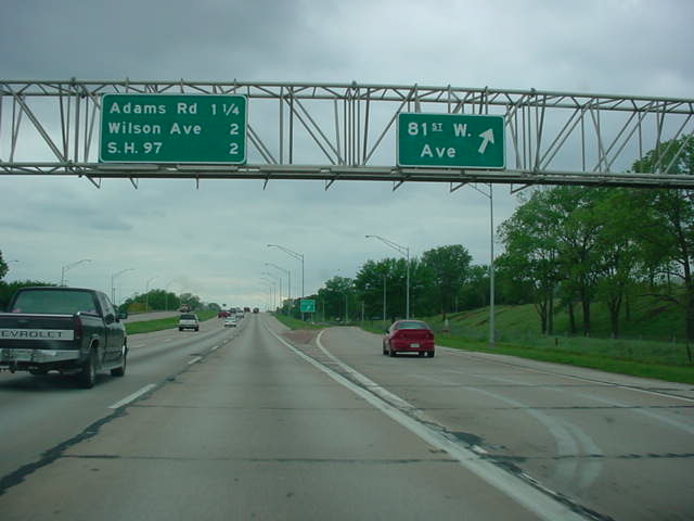
U.S. 64/412/OK 51
West at Sand Springs/Adams Rd. exit.
(Photo taken 4/25/03) |
 |
U.S. 64/412/OK 51
East at 81st W. Ave. exit. (Photo taken
4/25/03) |
 |
U.S. 64/412/OK 51
West at 81st W. Ave. exit. (Photo taken
4/25/03) |
 |
U.S. 64/412/OK 51
East at 65th W. Ave. exit. (Photo taken
4/25/03) |
 |
U.S. 64/412/OK 51
West at 65th W. Ave. exit. (Photo taken
4/25/03) |
 |
U.S. 64/412/OK 51
East at 49th W. Ave. exit. (Photo taken
4/25/03) |
 |
U.S. 64/412/OK 51
West at 49th W. Ave. exit. (Photo taken
4/25/03) |
 |
U.S. 64/412/OK 51
West at 33rd W. Ave./Easton St. exit. (Photo
taken 4/25/03) |
 |
U.S. 64/412/OK 51
East at Gilcrease Museum Road exit in
Tulsa. Interstate
244 is 1 1/4 miles ahead. (Photo
taken 4/25/03) |
 |
U.S. 64/412/OK 51
West approaching Gilcrease Museum Road
exit. The exit is still about 1/2 mile away. (Photo
taken 4/25/03) |
 |
U.S. 64/412/OK 51
West at Gilcrease Museum Road exit in
Tulsa. (Photo taken 4/25/03) |
 |
U.S. 64/412/OK 51
East at Quanah Ave. exit. Interstate 244 is
1/4 mile ahead. (Photo taken 4/25/03) |

 |
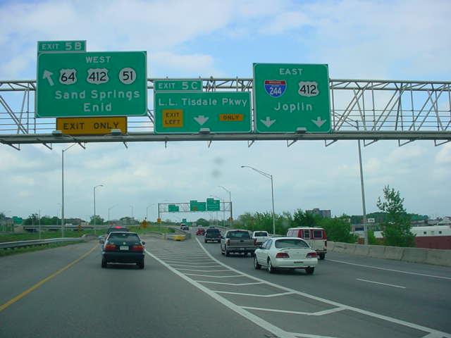
U.S. 64/412/OK 51
East approaching Interstate 244. U.S. 64
and OK 51 will head west (south) on the interstate for a
mile
before heading east with U.S. 75 North
on hidden Interstate
444,
while U.S. 412 continues straight ahead and duplexes with
Interstate 244 East. (Top photo taken 12/1/02, bottom
photo taken 5/21/04) |

 |
U.S. 64/412/OK 51
East at Interstate 244 West/U.S. 64/OK 51
East - Broken Arrow/Oklahoma City exit in Tulsa. (Top photo
taken
12/1/02, bottom photo taken 5/21/04) |
 |
Interstate 244 East/U.S. 64/OK 51 West
at Exit
5B - U.S.
64/U.S. 412/OK 51 West - Sand
Springs/Enid. (Photo taken
4/25/03) |
 |
Interstate 244 West/U.S. 64/OK 51 East
at Exit
4B - U.S.
75 North/U.S. 64/OK 51 East - Broken
Arrow. (Photo taken
5/21/04) |

 |
Hidden Interstate 444/U.S. 64/OK 51 East/U.S.
75 North at U.S.
75 North - Bartlesville exit. This
is the eastbound beginning of
the Broken Arrow
Expressway. These signs were replaced a
couple
months after this picture was taken. (Top photo taken
4/25/03, bottom photo taken 5/21/04) |
 |
U.S. 64/OK 51 East at Utica Ave. in
Tulsa. The Broken Arrow
Expressway northwest of Interstate 44 is old, substandard,
and even has an abandoned railroad track running through
its median! (Photo taken 5/21/04) |
 |
U.S. 64/OK 51 East at Lewis Ave.
(Photo taken 5/21/04) |
 |
Broken Arrow Expressway sign on U.S. 64/OK 51
East near
Lewis Ave. This name applies to the 15 miles of OK 51 between
U.S. 75 in downtown Tulsa and the Muskogee Turnpike in
Broken Arrow. (Photo taken 5/21/04) |
 |
U.S. 64/OK 51 East at 15th St.
(Photo taken 5/21/04) |
 |
U.S. 64/OK 51 East at 21st St.
(Photo taken 5/21/04) |
 |
U.S. 64/OK 51 East at Harvard Ave.
(Photo taken 5/21/04) |
 |
U.S. 64/OK 51 East at 31st
Street/Yale Ave. This exit also
leads to the Fairgrounds, Expo Square, and Drillers Stadium.
(Photo taken 5/21/04) |
 |
U.S. 64/OK 51 East at Sheridan Rd.
(Photo taken 5/21/04) |
 |
U.S. 64/OK 51 East approaching
Interstate 44/OK 66 - 1/2 mile.
(Photo taken 5/21/04) |
 |
U.S. 64/OK 51 East at Interstate
44/OK 66 West - Oklahoma
City. (Photo taken 5/21/04) |
 |
U.S. 64/OK 51 East at Interstate
44/OK 66 East - Joplin.
(Photo taken 5/21/04) |
 |
U.S. 64/OK 51 East at Memorial Dr.
(Photo taken 5/21/04) |
 |
U.S. 64/OK 51 East at Mingo Rd.
(Photo taken 5/21/04) |
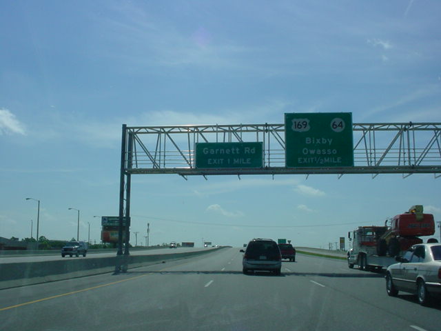
 |
U.S. 64/OK 51 East approaching U.S.
169/OK 64 (should be
U.S. 64) - 1/2 mile. (Photo taken 5/21/04) |
 |
U.S. 64/OK 51 East at U.S. 169
South/U.S. 64 East - Bixby.
(Photo taken 5/21/04) |
 |
U.S. 64 West/U.S. 169 North/Creek
Turnpike East approaching
Mingo Rd. - 1/2 mile, and Creek Turnpike East - 3/4 mile.
(Photo taken 9/4/03) |
 |
U.S. 64 West/U.S. 169 North/Creek
Turnpike East at Mingo
Rd. (Photo taken 9/4/03) |
 |
U.S. 64 West/U.S. 169 North/Creek
Turnpike East at Creek
Turnpike East - E. 96th St. S./ Broken Arrow. (Photo taken
9/4/03) |
 |
U.S. 64 West at OK 67 West in Bixby. I was in about half a mile
of
backed-up traffic at this intersection. About six minutes
after
entering the line, I finally got up to the light to get
this picture!
(Photo taken 1/7/03) |
 |
U.S. 64 West/OK 72 North at OK 72
North in Haskell. An error
U.S. 72 shield is present here. This error is a common sight
along OK 72. (Photo taken 10/31/03) |
 |
U.S. 64 West/U.S. 72 North assurance
shields just north of OK
104 in Haskell. Again, this sign assembly should have an OK
72 shield. (Photo taken 10/31/03) |
 |
U.S. 64 West/OK 72 North at OK 104
North in Haskell. OK
104 is seven miles long and connects to OK 51B at its other
end. (Photo taken 10/31/03) |

 |
U.S. 62/U.S. 64/OK 16 East at OK 162
North. OK 162 connects
to the town of
Taft. (Top photo taken 10/31/03, bottom
photo
taken 9/30/04) |
 |
U.S. 62/U.S. 64/OK 16
East at U.S. 69 in
Muskogee. U.S. 62
heads left, U.S. 64 heads
right, and OK 16 heads left. Business
U.S.
62 and Business U.S. 64 are straight ahead.
(Photo
taken 9/30/04) |
 |
U.S. 62/U.S. 64/OK 16 West at U.S.
62 West/U.S. 64 West/OK
72. (Photo taken 10/31/03) |
|
|
U.S. 62/U.S. 64/OK 16 East at OK 162
North. (Photo taken
10/31/03) |
 |
U.S. 64 East at Business U.S. 64
West/TO OK 165 in south
Muskogee. There isn't a need for the "TO" banner, as OK 165
does begin at this intersection. U.S. 64 heads off to the south
towards Warner. (Photo taken 10/31/03) |
 |
U.S. 64 East at U.S. 266 West/OK 2
South in Warner. U.S. 64
makes another turn here, this time to the east into Warner's
business district. (Photo taken 10/31/03) |

 |
U.S. 64 West at U.S. 266 West/OK 2
South. Interstate 40 is a
mile south of this intersection. (Top photo taken 10/31/03,
bottom photo taken 9/30/04) |
 |
U.S. 64 West at Muskogee Turnpike
West - Muskogee/Tulsa.
A half-diamond is in place here; there is no access from
Muskogee Turnpike West to U.S. 64 or from U.S. 64 to
Muskogee Turnpike East due to the proximity of Interstate 40,
1/4 mile to the south. (Photo taken 9/30/04) |
 |
U.S. 64 West/OK 100 South at U.S. 64
West. (Photo taken
9/30/04) |
 |
U.S. 64 West/OK 10 North at OK 10
North/OK 100 in Gore.
(Photo taken 9/26/03) |
 |
U.S. 64 West/OK 10 North assurance
shields just west of OK
10 South. (Photo taken 9/26/03) |
 |
U.S. 64 East/U.S. 59 North/Business
Loop I-40 East at U.S. 59
North in Sallisaw. (Photo taken 9/26/03) |
 |
U.S. 64 East at OK 141 West. OK 141
connects to U.S. 59
at its other end and goes through the town of Gans. (Photo
taken
5/21/04) |
 |
U.S. 64 West at Interstate 40 West
in Roland. (Photo taken
9/26/03) |
 |
U.S. 64 West at Interstate 40 East.
(Photo taken 9/26/03) |
 |
U.S. 64 East at U.S. 64D (should be
OK 64D) North. OK 64D
connects U.S. 64 to Interstate 40. Fort Smith, Arkansas, is less
than a mile ahead. (Photo taken 9/26/03) |
 |
"Oklahoma" sign on U.S. 64 West just
east of OK 64D. U.S.
64 will leave the Sooner State in 589 miles near Clayton, New
Mexico. (Photo taken 9/26/03) |
|