|

Home
Intersecting Highways:
Interstate 35
Interstate 40
Interstate 44
Interstate 235
Interstate 240
Indian Nation Turnpike
Muskogee Turnpike
U.S. 59
U.S. 64
U.S. 69
U.S. 75
U.S. 77
U.S. 81
U.S. 177
U.S. 183
U.S. 266
U.S. 270
U.S. 277
U.S. 281
U.S. 283
U.S. 377
OK 3
OK 5 (W)
OK 6
OK 8
OK 9
OK 10
OK 16
OK 18
OK 19
OK 27
OK 30
OK 34
OK 37 (N)
OK 39
OK 48
OK 49
OK 51
OK 52 (N)
OK 54 (N)
OK 56
OK Loop 56
OK 72
OK 76
OK 80
OK 82 (N)
OK 92 (S)
OK 99
OK 102
OK 115
OK 130
OK 162
OK 165
OK 270
Latest Updates
Interstate Highways
U.S. Highways
State Highway
Terminus Gallery
E-mail
OKHighways.com
(Spam filter in effect: Use @ in place of #) |
|
Highway
Review:
U.S. 62 is an unusual
highway. It starts in El Paso, Texas, at the Mexican border, and
goes all the way to Niagara Falls, New York. It is signed
east-west until Kentucky, then it heads north the rest of the
way. It travels through Texas, Oklahoma, Arkansas, Missouri,
Kentucky, Ohio, Pennsylvania, and New York.
In Oklahoma U.S. 62
begins five miles west of Hollis. It runs east-west until Lawton,
then it joins Interstate 44 and starts heading north for a few
miles before exiting off. In Anadarko, U.S. 62 (co-signed with
U.S. 277 at this point) heads east once again before the highways
curve to the north once again east of Blanchard. U.S. 62 heads
north with Interstate 44 East and head into Oklahoma City. U.S.
62 then heads east on Interstate 240 between I-44 and Interstate
35, then U.S. 62 goes north with Interstate 35 for about 10 miles
before U.S. 62 heads east. The highway runs parallel to
Interstate 40 for most of the remainder of its distance in
Oklahoma. In Henryetta, U.S. 62 heads north with U.S. 75 for 12
miles before U.S. 62 starts heading east towards Muskogee. At
this point the highway begins making strides away from Interstate
40 and finds its last major town in Tahlequah. Slightly less than
30 miles east of Tahlequah, the highway enters Arkansas, and
Fayetteville is just a few miles away.
Highway
Information:
Distance: 406.0 miles
Counties traveled through: Harmon, Jackson, Kiowa, Comanche, Caddo, Grady,
McClain, Cleveland, Oklahoma, Lincoln, Okfuskee, Okmulgee, Muskogee, Cherokee,
Adair
Highway intersections: OK 30 (Mile 5.0), OK 5 (Mile 13.3), OK 34 (Mile 25.4), OK
6 (Mile 33.9), U.S. 283/OK 6 (Mile 38.9), Business U.S. 62 (Mile 56.3),
U.S. 183 (Mile 59.9), Business U.S. 62 (Mile 63.2), OK 54 (Mile 65.8), OK 115
(Mile 78.9), Interstate 44/U.S. 277/U.S. 281 (Mile 94.0), OK 49 (Mile 99.6),
Interstate 44 (Mile 100.6), U.S. 277 (Mile 105.0), OK 19 (Mile 113.9), OK 19
(Mile 114.4), OK 9 (Mile 124.6), U.S. 281/OK 8 (Mile 133.0), OK 8 (Mile 133.5),
U.S. 81 (Mile 149.3), U.S. 81/U.S. 277/OK 92 (Mile 151.1), Interstate 44 (Mile
152.6), OK 92 (Mile 154.3), OK 39 (Mile 157.6), OK 76 (Mile 169.1), OK 76 (Mile
170.1), H.E. Bailey Turnpike Spur/OK 9 (Mile 174.8), OK 130 (Mile 179.3),
Interstate 44/U.S. 277 (Mile 181.9), OK 37 (Mile 183.6), OK 37 (Mile 186.4),
Interstate 44/Interstate 240/OK 3 (Mile 190.8), Interstate 35/Interstate
240/U.S. 77/OK 3 (Mile 195.4), Interstate 40/Interstate 235/U.S. 77/U.S. 270
(Mile 200.4), Interstate 40/U.S. 270 (Mile 201.1), Interstate 35 (Mile 203.7),
OK 270 (Mile 220.8), OK 102 (Mile 225.4), U.S. 177 (Mile 230.7), OK 18 (Mile
236.8), U.S. 377/OK 99 (Mile 248.9), OK 48 (Mile 266.8), OK 27/OK 56 (Mile
272.6), OK 56 (Miles 272.8), Interstate 40/OK 27 (Mile 273.4), U.S. 75 (Mile
283.5), Business U.S. 62/Business U.S. 75 (Mile 289.5), Indian Nation Turnpike
(Mile 292.1), Interstate 40 (Mile 292.3), Business U.S. 62/Business U.S. 75
(Mile 293.2), U.S. 266 (Mile 294.5), U.S. 75 (Mile 305.3), OK Loop 56 (Mile
307.0), OK 52 (Mile 311.0), OK 72 (Mile 322.4), U.S. 64/OK 16/OK 72 (Mile
331.5), OK 162 (Mile 336.5), U.S. 64/U.S. 69/Business U.S. 62/Business U.S. 64
(Mile 345.3), U.S. 69 (Mile 346.3), OK 16 (Mile 349.8), Muskogee Turnpike/OK 165
(Mile 351.5), OK 10 (Mile 353.8), OK 80 (Mile 355.6), OK 82 (Mile 372.2), OK 51
(Mile 374.3), OK 82 (Mile 376.7), OK 10 (Mile 378.6), OK 51 (Mile 384.3), U.S.
59 (Mile 403.1)
Highway duplexes: OK 6 (Miles 33.9-38.9, 5.0 miles), Interstate 44 (Miles
94.0-100.6, 6.6 miles), U.S. 277 (Miles 94.0-105.0, 11.0 miles), U.S. 281 (Miles
94.0-133.0, 39.0 miles), OK 19 (Miles 113.9-114.4, 0.5 mile), OK 9 (Miles
124.6-174.8, 50.2 miles), OK 8 (Miles 133.0-133.5, 0.5 mile), U.S. 81 (Miles
149.3-151.1, 1.8 miles), OK 92 (Miles 151.1-154.3, 3.2 miles), U.S. 277 (Miles
151.1-181.9, 30.8 miles), Interstate 44 (Miles 181.9-190.8, 8.9 miles), OK 37
(Miles 183.6-186.4, 2.8 miles), Interstate 240/OK 3 (Miles 190.8-195.4, 4.6
miles), Interstate 35 (Miles 195.4-203.7, 8.3 miles), U.S. 77 (Miles
195.4-200.4, 5.0 miles), Interstate 40/U.S. 270 (Miles 200.4-201.1, 0.7 mile),
OK 56 (Miles 272.6-272.8, 0.2 mile), OK 27 (Miles 272.6-273.4, 0.8 mile),
Interstate 40 (Miles 273.4-292.3, 18.9 miles), U.S. 75 (Miles 283.5-305.3, 21.8
miles), OK 72 (Miles 322.4-331.5, 9.1 miles), U.S. 64 (Miles 331.5-345.3, 13.8
miles), U.S. 69 (Miles 345.3-346.3, 1.0 mile), OK 16 (Miles 331.5-349.8, 18.3
miles), OK 10 (Miles 353.8-378.6, 24.8 miles), OK 82 (Miles 372.2-376.7, 4.5
miles), OK 51 (Miles 374.3-384.3, 10.0 miles)
PICTURES
 |
U.S. 62 West at OK 30 North in
Hollis. This
picture was taken while my car was almost
on fumes, so it was a miracle that the car
was rolling at normal speed when I took
this picture! (Photo
taken 10/11/02) |
 |
U.S. 62 East approaching OK 30
North. At
the time of this picture I had just breathed a
huge sigh of relief because I now had a full
tank of gas to get through the rest of this
particular day's roadtrip through southwest
Oklahoma. (Photo taken 10/11/02) |
 |
U.S. 62 West/OK 6 South at OK 6
South.
(Photo taken 10/11/02) |
 |
U.S. 62 West/OK 6 South
approaching OK
6 South west of Altus. The intersection is the
end of OK 6's unsigned multiplex with U.S.
62. (Photo taken 10/11/02) |
 |
U.S. 62 East at Business U.S. 62
East near
Snyder. This business spur route serves
Snyder while U.S. 62 continues as a 4-lane
divided highway all the way from west of
Altus to Lawton. (Photo taken 10/11/02) |
 |
U.S. 62 East at U.S. 183 exit
south of
Snyder. (Photo taken 10/11/02) |
 |
U.S. 62 East at Business U.S. 62
West
southeast of Snyder. This is the eastern
end of the business spur. (Photo taken
10/11/02) |
 |
U.S. 62 East at OK 54 North west
of Cache.
The northern OK 54 begins here and heads
north towards Interstate 40 and Weatherford.
(Photo taken 10/11/02) |
 |
U.S. 62 West at OK 115 - Cache. The
diamond interchange marks the southern
end of OK 115. (Photo taken 5/12/04) |
 |
U.S. 62 West at Deyo. This exit is
located
just west of Lawton. (Photo taken 5/12/04) |
 |
U.S. 62 West at Sheridan Rd.
Southbound
in Lawton. This once marked the western
terminus of OK 7. (Photo taken 5/12/04) |
 |
U.S. 62 West at Sheridan Rd.
Northbound
in Lawton. (Photo taken 5/12/04) |
 |
U.S. 62 East at the Ft. Sill Blvd.
southbound
exit in Lawton. U.S. 62 through the north part
of Lawton is a 4-lane mini-freeway of sorts
with a 50 mph speed limit. (Photo taken
9/6/02) |
 |
U.S. 62 West at Ft. Sill Blvd.
Southbound.
(Photo taken 5/12/04) |
 |
U.S. 62 East at the Ft. Sill Blvd.
northbound
exit in Lawton. This exit leads motorists right
to a gate for Ft. Sill. (Photo taken 9/6/02) |
 |
U.S. 62 West at Ft. Sill Blvd.
Northbound.
(Photo taken 5/12/04) |
 |
Interstate 44/U.S. 62
West/U.S.
277/281
South at unmarked Exit 40B-U.S. 62 West in
Lawton. (Photo taken 10/11/02) |
 |
Interstate 44/U.S. 62
East at Exit
46-U.S. 62
East/U.S. 277/281 North. (Photo taken
9/6/02) |
 |
U.S. 62/OK 9
West/U.S. 277/OK 92
South
at U.S. 81/277/OK 92 South in downtown
Chickasha. (Photo taken 10/4/02) |
 |
U.S. 62/OK 9
West/U.S. 277/OK 92
South
approaching U.S. 81/277/OK 92 South.
(Photo taken 10/4/02) |
 |
U.S. 62/OK 9
West/U.S. 277/OK 92
South
at Interstate 44 East east of Chickasha.
(Photo taken 10/4/02) |
 |
U.S. 62/OK 9
East/U.S. 277/OK 92
North
approaching OK 92 North east of Chickasha.
(Photo taken 10/4/02) |
 |
U.S. 62 West, U.S. 277 South, and
OK 9
West shields located just west of the OK 92
North intersection pictured above. OK 92
South should be signed, but it isn't. (Photo
taken 10/4/02) |
 |
U.S. 62/OK 9
East/U.S. 277 North
at OK 39
East. This is the western terminus of OK 39.
(Photo taken 10/4/02) |
 |
East U.S. 62, OK 9, and North U.S.
277
shields located just east of the OK 39
junction pictured above. (Photo taken
10/4/02) |
 |
Mileage sign located just past OK
39. OK
76 and Blanchard are 13 miles away, while
Norman is 25 miles away via OK 9 East.
(Photo taken 10/4/02) |
 |
U.S. 62/OK 9
East/U.S. 277 North
at OK 76
South near Blanchard. OK 76 joins the three
highways for a mile before heading north
towards OK 130 and OK 37. (Photo taken
10/4/02) |
 |
Shields for U.S. 62, U.S. 277, and
OK 9
just past the intersection above. OK 76 has
not officially joined the highways yet. (Photo
taken 10/4/02) |
 |
U.S. 62, U.S. 277, OK 9, and OK 76
shields
after OK 76 North joins the other three
highways. (Photo taken 10/4/02) |
 |
The split of OK 76 North from U.S.
62, U.S.
277, and OK 9 in downtown Blanchard.
(Photo taken 10/4/02) |
 |
U.S. 62/U.S. 277/OK 9 shields just
north of
Blanchard. This is the final time that these
three highways are signed, as OK 9 departs
on its own a couple miles ahead. (Photo
taken 10/4/02) |
 |
U.S. 62/OK 9
East/U.S. 277 North
at OK 9
East between Newcastle and Blanchard. OK
9 heads towards Interstate 35 and Norman
at this point. (Photo taken 10/4/02) |
 |
U.S. 62/OK 9
West/U.S. 277 South at OK 9
East. (Photo taken 2/13/04) |
 |
U.S. 62 East/U.S. 277 North at H.E. Bailey
Turnpike Spur West. The spur heads
towards Interstate 44 and
connects to OK 4,
Mustang, and Yukon.
(Photo taken 10/4/02) |
 |
U.S. 62 West/U.S. 277 South at H.E.
Bailey
Turnpike Spur West. (Photo taken 2/13/04) |
 |
U.S. 62 East/U.S. 277 North at OK
130 West
in Newcastle. This is the eastern terminus of
OK 130, which connects OK 76 to U.S. 62 &
277. (Photo taken 10/4/02) |
 |
U.S. 62 West/U.S. 277 South at OK
130
West. (Photo taken 2/13/04) |
 |
Slightly unusual U.S. 62/277
shields just north
of the OK 130 junction. The boldface type on
the numbers is common throughout this
segment of highway. (Photo taken 10/4/02) |
 |
U.S. 62 East/U.S. 277 North
approaching
Interstate 44 - one-half mile. U.S. 277 is just
about to come to an end. (Photo taken
10/4/02) |
 |
U.S. 62 East at Interstate 44
north of
Newcastle. U.S. 277 finds its northern
terminus at this interchange. (Photo taken
8/24/02) |
 |
Interstate 44/U.S. 62
West at Exit
107-U.S.
62 West/U.S. 277 South in Newcastle. U.S.
62 rejoins Interstate 44 61 miles later at the
southern end of the H.E. Bailey Turnpike's
northern section. (Photo taken 12/11/03) |
 |
Interstate 44/U.S. 62
East at Exit
115-
Interstate 240/U.S. 62/OK 3 East in south
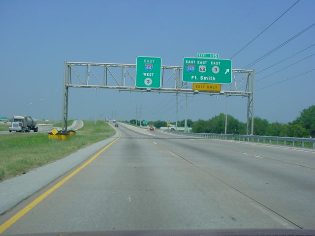
Oklahoma City. U.S. 62 joins Interstate 240
for four miles before it exits off on Interstate
35 North. (Photo taken 9/11/02) |
 |
Interstate 240/U.S. 62
East at
Exit 4B-
Interstate 35 North/U.S. 62 East in south
Oklahoma City. (Photo taken 8/28/02) |
 |
Interstate 35 North/U.S. 62
East
at the
Interstate 35 North/Interstate 40 East exit.
(Photo taken 8/24/02) |
 |
Interstate 35 North/U.S. 62
East
at Exit 130 -
U.S. 62 East/N.E. 23rd St. in Oklahoma
City. U.S. 62 isn't signed with an interstate
again until Interstate 40 in Okemah. (Photo
taken 5/19/03) |
 |
U.S. 62 East
approaching OK 270 in
Harrah. At the intersection just ahead, the
highway is signed U.S. 270, which is what
it once was before the federal highway
was rerouted to follow Interstate 40. (Photo
taken 9/30/04) |
 |
U.S. 62 East
at OK 270 East. (Photo taken
9/21/04) |
 |
U.S. 62 East
at OK 102. (Photo taken
9/30/04) |
 |
U.S. 62 East
at U.S. 177. (Photo taken
9/30/04) |
 |
U.S. 62 East
at OK 18 in Meeker. (Photo
taken 9/30/04) |
 |
U.S. 62 East
at U.S. 377/OK 99 in Prague.
(Photo taken 9/30/04) |
 |
U.S. 62 East
at OK 48. (Photo taken
9/30/04) |
 |
U.S. 62 East
at OK 27/OK 56. U.S. 62
heads off to the right and will begin a
duplex with Interstate 40 in one mile.
(Photo taken 9/30/04) |
 |
U.S. 62 West/OK 27/OK 56 North at
U.S.
62 West/OK 56 North in Okemah. OK 27
ends at this intersection. (Photo taken
1/7/03) |
 |
TO
I-40/U.S. 62 East/OK 27/OK 56 South
assurance shields just south of U.S. 62
West/OK 56 North in Okemah. (Photo
taken 1/7/03) |
 |
U.S. 62 West/OK 27 North at OK 56
South
in Okemah. (Photo taken 1/7/03) |
 |
U.S. 62 East/OK 27/OK 56 South at OK
56
South. (Photo taken 1/7/03) |
 |
U.S. 62 East/OK 27 South at
Interstate 40
West. (Photo taken 1/7/03) |
 |
Interstate 40/U.S. 62 West at Exit
221 -
U.S. 62/OK 27 - Okemah/Wetumka.
(Photo taken 12/21/03) |
 |
Interstate 40/U.S. 62 East/U.S. 75
North at
Exit 240A - Indian Nation Turnpike -
McAlester/Dallas. U.S. 62 East and U.S.
75 North depart in 1/2 mile. (Photo
taken 9/26/03) |
 |
Indian Nation Turnpike/U.S. 75 North/U.S.
62 East at Interstate 40 West.
(Photo
taken 10/31/03) |
 |
U.S. 62 East/U.S. 75 North at
Business
U.S. 62/Business U.S. 75 in Henryetta.
(Photo taken 10/31/03) |
 |
U.S. 62
East/U.S. 75 North at U.S. 266 East
in Henryetta. U.S. 266 is one of the shortest
U.S. routes in the country at a length of just
43 miles. (Photo taken 10/31/03) |
 |
U.S. 62 East/U.S. 75 North at U.S.
62 East
in Okmulgee. (Photo taken 10/31/03) |
 |
U.S. 62 East at OK Loop 56 North on
the
east side of Okmulgee. OK Loop 56
connects U.S. 62 to U.S. 75 to the
northeast of Okmulgee. (Photo taken
10/31/03) |
 |
U.S. 62 East
approaching OK 52. Most of
the OK 52 assurance shields in Morris
have a U.S. shield instead. (Photo taken
9/30/04) |
 |
U.S. 62 East
at OK 52 in Morris. (Photo
taken 9/30/04) |
 |
U.S. 62 West at U.S. 52 in Morris.
Except
that U.S. 52 goes nowhere near Oklahoma!
The shield should be for OK 52. (Photo
taken 10/31/03) |
 |
U.S. 62 East
at OK 72. U.S. 62 heads to
the north. (Photo taken 9/30/04) |
 |
U.S. 62 East/OK
72 North assurance
shields just north of the intersection above.
This duplex lasts for nine miles. (Photo
taken 9/30/04) |

 |
U.S. 62 East/OK 72 North at U.S. 62
East/
U.S. 64/OK 16. (Top photo taken 10/31/03,
bottom photo taken 9/30/04) |
 |
U.S. 62/U.S. 64/OK 16 West at U.S.
62
West/U.S. 64 West/OK 72. (Photo taken
10/31/03) |
 |
OK
16/U.S. 62/U.S. 64 East assurance
shields just east of OK 72. The highways
are multiplexed for the next 14 miles.
(Photo taken 10/31/03) |

 |
U.S. 62/U.S. 64/OK 16 East at OK 162
North. OK 162 connects to the town of
Taft. (Top photo taken 10/31/03, bottom
photo taken 9/30/04) |
 |
U.S. 62/U.S. 64/OK 16
East at U.S. 69 in
Muskogee. U.S. 62 heads left, U.S. 62 heads
right, and OK 16 heads left. Business U.S.
62 and Business U.S. 64 are straight ahead.
(Photo taken 9/30/04) |
 |
U.S. 62/OK 16
East/U.S. 69 North at U.S.
62/OK 16 East. (Photo taken 9/30/04) |
 |
U.S. 62/OK 16
East at Business U.S. 62
West. (Photo taken 9/30/04) |
 |
U.S. 62/OK 16
East at OK 16 North. For
the rest of its route, OK 16 is signed
north-south. (Photo taken 9/30/04) |
 |
U.S. 62 East
approaching OK 165/
Muskogee Turnpike - 1 mile. This button
copy relic is one of few left in the state with
a full button copy shield as well. (Photo
taken 9/30/04) |
 |
U.S. 62 East
approaching OK 165 South -
Next Right. (Photo taken 9/30/04) |
 |
U.S. 62 East
approaching OK 165 North -
Second Right. This sign is another full
button copy relic still in use. (Photo taken
9/30/04) |
 |
U.S. 62 East
at OK 165 South. (Photo
taken 9/30/04) |

 |
U.S. 62 East at OK 165 North - Port
of
Muskogee/Tulsa exit. (Top photo taken
10/31/03, bottom photo taken 9/30/04) |
 |
U.S. 62 East
at OK 10 South - Braggs/
Camp Gruber. (Photo taken 9/30/04) |

 |
U.S. 62 East/OK 10 North at OK 80
North - Ft. Gibson. (Top photo taken 9/26/03,
bottom photo taken 9/30/04) |
 |
U.S. 62 East/OK 10 North at OK 82
South
near Park Hill. Tahlequah is about five
miles straight ahead. (Photo taken 9/30/04) |
 |
U.S. 62 West at OK 51 East. U.S. 62
is hilly and curvy between Tahlequah and
Westville. (Photo taken 9/4/03) |
|